The best international world maps for learning, decorating, and planning travel are curated below. This guide helps buyers choose maps that are durable, well detailed, and easy to write on or scratch off. Each product is suitable for different spaces and needs—from classrooms and offices to family rooms and travel planners. The top picks emphasize clear political boundaries, color coding, and practical finishes like lamination or foldable formats. Read on to find the right map for you and your space.
| Product | |||
|---|---|---|---|
| Maps International Giant World Map (46 x 80) Laminated | 46 x 80 inches | ||
| Maps International World Map (23 x 33) Silk Art Paper Folded | 23 x 33 inches | ||
| Maps International World Wall Map (47 x 33) Front Lamination | 47 x 33 inches | ||
| Scratch The World Travel Map (23 x 33) + USA (11 x 17) | 23 x 33 inches (world) + 11 x 17 inches (USA) | ||
| Maps International Giant World Map Classic (46 x 80) Laminated | 46 x 80 inches |
Below are five carefully selected maps that cover a range of needs—from write-on classroom maps to scratch-off travel posters. Each item includes clear reasoning on who should choose it and why, plus a note of any limitation to consider.
Maps International Giant World Map Laminated 46 x 80

This giant wall map is the largest single printed sheet available, sized for impactful viewing in classrooms or open spaces. It uses a 1:20m scale with hill and sea shading for depth. Heat-sealed lamination allows use with whiteboard markers and easy cleaning. Best for classrooms or large family rooms where detail and impact matter.
Who it’s best for: educators and space planners needing a striking, durable poster that can be annotated and wiped clean. Why selected: its size, updated 2026 political detail, and write-on laminate make it highly adaptable for lessons and displays.
Caution: its sheer size requires ample wall space and structural mounting considerations. If you have a smaller room, this may overwhelm the space.
Maps International World Map Silk Art Paper 23 x 33 Folded
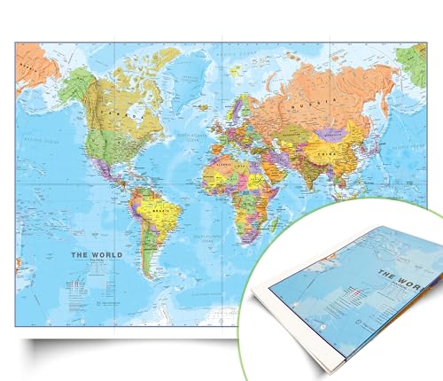
This folded world map uses silk art paper with a high-quality finish, updated for 2026 political boundaries. Its 1:40m scale is detailed enough for classroom posters and home office decor without occupying large wall space. Best for: smaller rooms, deskside displays, or travel-themed setups.
Who it’s best for: readers who want a refined, foldable map that ships flat and stores compactly when not in use. Why selected: combination of up-to-date political details and elegant silk finish.
Caution: folded format means it may require careful mounting for a perfectly flat display when hung.
Maps International World Wall Map 47 x 33 Front Lamination
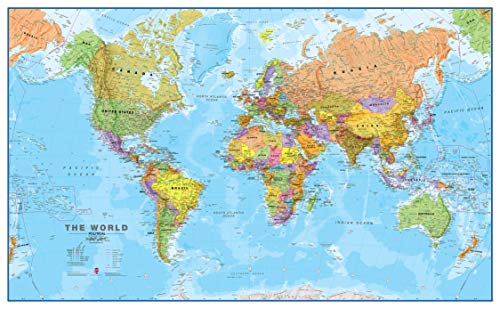
This poster-style world map uses a political color scheme with hill shading for clear country separation. The front-laminated surface supports write-on, wipe-clean use, making it a practical classroom or office piece. Best for: mid-to-large rooms that value a bold, colorful display without extra frames.
Who it’s best for: teachers, students, and professionals who want a durable, ready-to-mark map. Why selected: strong color differentiation and user-friendly lamination for frequent notes.
Caution: 47 x 33 inches is large but more compact than the giant maps, so users with very large walls may still prefer bigger formats.
Scratch The World Travel Map 23 x 33 + USA 11 x 17
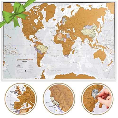
This scratch-off map displays world destinations with country borders and famous features. The extra-large world detail supports identifying national boundaries and major cities underneath the scratch layer. Best for: travel enthusiasts and planning-minded buyers who want to track journeys over time.
Who it’s best for: gift-givers and adventure planners seeking a frameable, interactive map. Why selected: the scratch-off design adds a tangible planning element and has broad appeal.
Caution: the scratch coating requires careful handling to avoid accidental scratches on areas you want to keep visible.
Maps International Giant World Map Classic Laminated
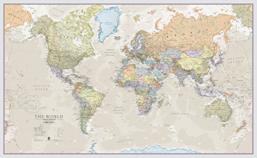
Classic giant world map poster with laminated finish features a 46 x 80 inch format and a 1:20m scale. It complements classroom decor and large office walls, providing a timeless political map with sturdy lamination. Best for: schools and large spaces needing a traditional, durable world map presence.
Who it’s best for: administrators and educators seeking a dependable, long-lasting display. Why selected: classic styling and robust laminate offer consistent readability and longevity.
Caution: its classic look may not include the latest microtonal boundary changes as frequently as some digital maps; verify update recency if precision is critical.
Buying Guide: What To Consider When Purchasing An International World Map
Size and space: Measure wall area to choose a map that fits without overpowering the room. Large formats provide immersive viewing, while compact options fit home offices or classrooms with limited space.
Finish and durability: Laminated maps support writing and cleaning, making them classroom-friendly. Folded Silk Art or front-laminated sheets balance portability with a premium look for homes or offices.
Detail level: For teaching or travel planning, 1:20m maps reveal more geographic detail, whereas 1:40m maps show broader country outlines. Consider how much country detail and labeling you want visible.
Interactivity: Write-on maps support ongoing lessons and notes. Scratch-off maps add a playful, motivational element for travelers and students tracking journeys.
Color and style: Color-coding improves readability. Classic tones blend with various décor, while vibrant palettes highlight regions more distinctly.
Update frequency: Political boundaries shift over time. If currency with current borders is essential, choose maps marketed as updated in the current year, or verify a recent update cycle.
Frequently Asked Questions
- What size map is best for a classroom?
- Do laminated maps allow writing on them?
- Are scratch-off maps good for travel planning?
- Is a folded map harder to display?
- Should I prefer political or physical shading?
Large formats (around 46 x 80 inches) are ideal for classrooms with multiple students and a central viewing point.
Yes. Laminated maps are designed for use with dry-erase markers and can be wiped clean.
Yes. They provide a visual, interactive way to track destinations and plan future trips.
Folded maps require careful mounting to lay flat, but they save wall space and are easy to store when not in use.
Political shading helps identify countries and borders clearly, while hill shading emphasizes terrain, useful for geography lessons and travel planning.